
PAGASA Satellite

Source: PAGASA
NOAA Satellites
Infrared

Visibility

Water Vapor

Source: NOAA
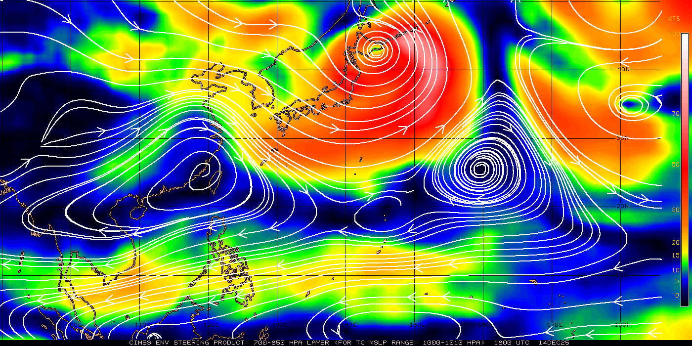
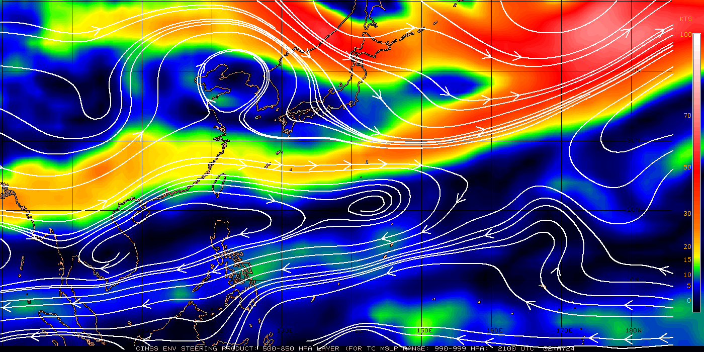
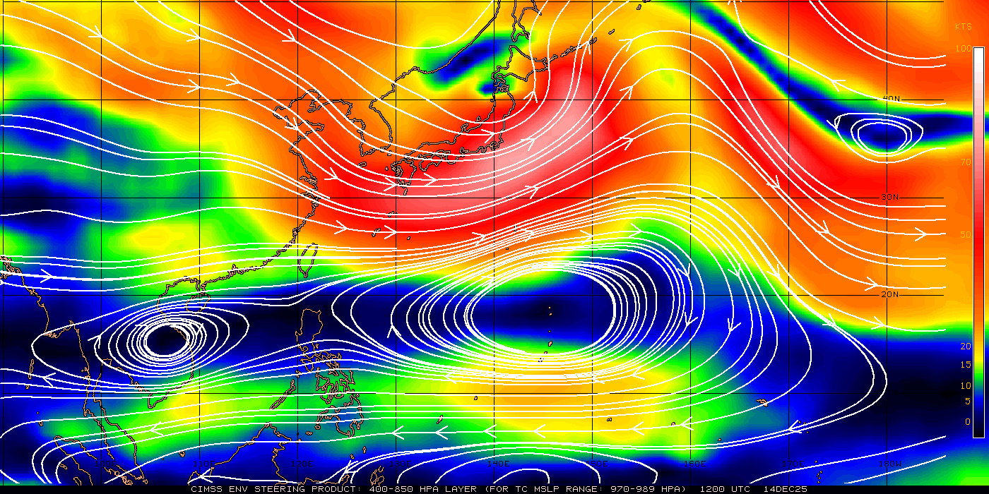
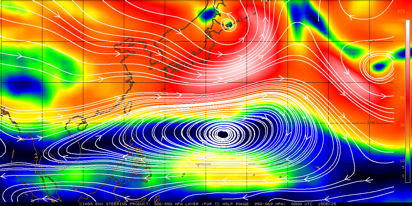
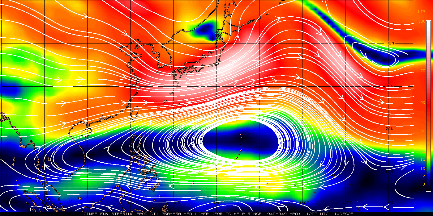
Streamline Analysis
Stream Line Analysis shows the general
movement of air in different elevations in
the atmospher
Current Western Pacific 700-850 mb Mean Wind Analysis
(TC Sfc Pressure Range 1000-1010 mbs)
Current Western Pacific 500-850 mb Mean Wind Analysis
(TC Sfc Pressure Range 990-999 mbs)
Current Western Pacific 400-850 mb Mean Wind Analysis
(TC Sfc Pressure Range 979-989 mbs)
Current Western Pacific 300-850 mb Mean Wind Analysis
(TC Sfc Pressure Range 950-969 mbs)
Current Western Pacific 250-850 mb Mean Wind Analysis
(TC Sfc Pressure Range 940-949 mbs)
Current Western Pacific 200-700 mb Mean Wind Analysis
(TC Sfc Pressure Range <940 mbs)
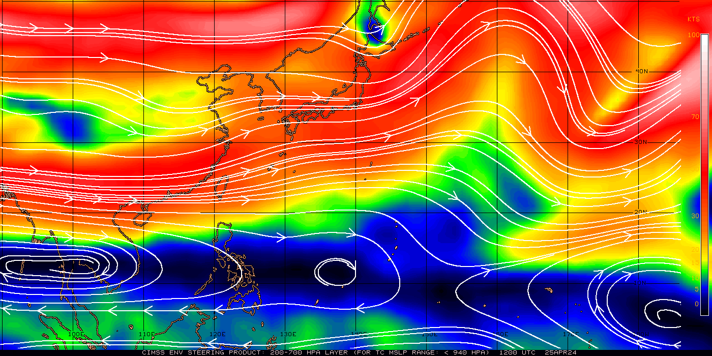
Source: University of Wisconsin-SSEC
Wind Direction & Force
Chart:

Upper Level Winds
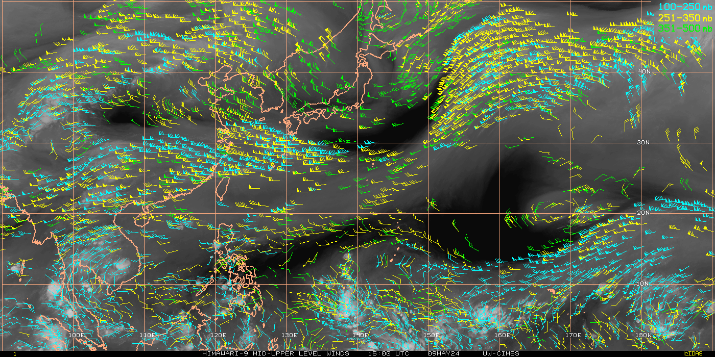
Lower Level Winds
Wind Shea

Wind Shear Forecast
Sea Surface Temperature
![]()
